Saltu al enhavo

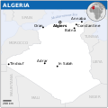
Dosiero:Algeria - Location Map (2013) - DZA - UNOCHA.svg

Paĝenhavo ne ekzistas en aliaj lingvoj.
El Vikinovaĵoj, libera retgazeto

Fonta dosiero (SVG-dosiero, 254 × 254 rastrumeroj, grandeco de dosiero: 345 KB)

Bildigi tiun ĉi bildon en .

Ĉi tiu dosiero estas de Wikimedia Commons kaj estas uzebla de aliaj projektoj. Jen la priskribo en ties dosier-priskriba paĝo.

Resumo

Priskribo
Català: Mapa de localització d'Algèria.
English: Locator map of Algeria.
Dato
Fonto
English: Algeria Locator Map (ReliefWeb), ESRI, UNCS
Aŭtoro
Ceteraj versioj
SVG genesis
InfoField
 
The SVG code is valid.
 
Ĉi tiu dosiero estas kreita per Inkscape.
 
 This map uses embedded text that can be easily translated using a text editor.
Traduku ĉi tiun dosieron

Ĉi tiu SVG-dosiero enhavas enkonstruitan tekston, kiu estas tradukebla en vian lingvon uzante ilon por traduki SVG-dosierojn aŭ ajnan kapablan SVG-redaktilon. Por pliaj informoj vidu: Pri tradukado de SVG-dosieroj.

This file is translated using SVG <switch> elements. All translations are stored in the same file! Learn more.

For most Wikipedia projects, you can embed the file normally (without a lang parameter). The Wikipedia will use its language if the SVG file supports that language. For example, the German Wikipedia will use German if the SVG file has German. To embed this file in a particular language use the lang parameter with the appropriate language code, e.g. [[File:Algeria - Location Map (2013) - DZA - UNOCHA.svg|lang=en]] for the English version. Do not specify a lang parameter if it is not needed. The parameter may prevent the use of a subsequent translation.

To translate the text into your language, you can use the SVG Translate tool. Alternatively, you can download the file to your computer, add your translations using whatever software you're familiar with, and re-upload it with the same name. You will find help in Graphics Lab if you're not sure how to do this.

Permesiloj:

w:eo:Creative Commons
atribuite
Ĉi tiu dosiero estas disponebla laŭ la permesilo Krea Komunaĵo Atribuite 3.0 Neadaptita.
Atribuite: OCHA
Vi rajtas:
  • kunhavigi – kopii, distribui kaj publikigi la verkon
  • aliigi – modifi, adapti, kompletigi, transformi, uzi la tutan verkon aŭ ties partojn, memstare aŭ en aliaj verkoj
La verko rajtas esti kunhavigata nur:
  • atribuite – Vi devas atribui aŭtorecon, liveri ligilon al la permesilo kaj marki ĉu ŝanĝoj estis faritaj. Faru tion en aprobinda maniero, tamen ne sugestante, ke permesinto aprobas vin aŭ vian uzon.
This map is part of a collection of 216 free country maps, created by the UN Office for the Coordination of Humanitarian Affairs (OCHA), to be used in print, web or broadcast products.

The ReliefWeb Location Maps released here are maps that highlight a country, its capital, major populated places and the surrounding regions.

Attribution Requirements

Using the map without modifications: ensure that the sources and the disclaimer are below the map. Credit as follows: "Credit: OCHA".

For use with alteration: remove the OCHA logo and disclaimer following any modification to the map, but keep the data sources as mentioned below the map. Credit the modified map as follows: "Based on OCHA map". You are responsible for the content of your map.

We are keen to receive your feedback and hear how you used OCHA's maps. We would be grateful if you would notify us by e-mail and share your work with us.

UN Disclaimer
The designations employed and the presentation of material of this map do not imply the expression of any opinion whatsoever on the part of the Secretariat of the United Nations concerning the legal status of any country, territory, city or area or of its authorities or concerning the delimitation of its frontiers or boundaries.

Titoloj

Donu unulinian priskribon de la enhavo de ĉi tiu dosiero

Eroj prezentitaj en ĉi tiu dosiero

montras

image/svg+xml

4e9506463362bdb7077016635dd664e01da5ab58

349 720 bajto

254 rastrumero

254 rastrumero

Dosiera historio

Klaku daton/tempon por vidi la dosieron kia ĝi aspektis tiam.

Dato/tempoBildetoDimensiojUzantoKomento
nuna18:06, 4 dec. 2024Bildeto por versio ekde 18:06, 4 dec. 2024254 × 254 (345 KB)ManlleusFile uploaded using svgtranslate tool (https://svgtranslate.toolforge.org/). Added translation for ca.
00:33, 19 nov. 2022Bildeto por versio ekde 00:33, 19 nov. 2022254 × 254 (342 KB)Pengetik-AMFile uploaded using svgtranslate tool (https://svgtranslate.toolforge.org/). Added translation for id.
16:16, 1 mar. 2021Bildeto por versio ekde 16:16, 1 mar. 2021254 × 254 (340 KB)Trần Nguyễn Minh HuyFile uploaded using svgtranslate tool (https://svgtranslate.toolforge.org/). Added translation for vi.
15:47, 30 okt. 2014Bildeto por versio ekde 15:47, 30 okt. 2014254 × 254 (342 KB)Dyln1Removed watermark.
00:20, 21 apr. 2014Bildeto por versio ekde 00:20, 21 apr. 2014254 × 254 (385 KB)UN OCHA maps bot== {{int:filedesc}} == {{Information |description={{en|1=Locator map of Algeria.}} |date=2013 |source={{en|1=[http://reliefweb.int/map/algeria/algeria-location-map-2013 Algeria Locator Map (ReliefWeb)]}} |author={{en|1=[[w:en:United Na...

La jena paĝo ligas al ĉi tiu dosiero:

Suma uzado de la dosiero

La jenaj aliaj vikioj utiligas ĉi tiun dosieron:

Vidi plian ĝeneralan uzadon de ĉi tiu dosiero.

Metadatumoj